Bird backpacks: GPS tagging of rhinoceros auklets and pigeon guillemots on Protection Island
In an effort to establish a better understanding of the foraging habits of rhinoceros auklets and pigeon guillemots on Protection Island, Liam Pendleton’s seabird research has involved GPS tagging and monitoring of these seabird species to delineate key foraging locations in the waters surrounding the island. Rhinoceros auklets migrate all along the West Coast of the US and Canada, and nest on the same island as pigeon guillemots, featured in a previous article by SAFS.
An interesting fact about rhinoceros auklets is that they forage entirely at sea, usually in deep water area sometimes beyond sight of land. How do we find out where they go to forage? What are the characteristics of the spots they choose? Are these sites at risk by human activity?
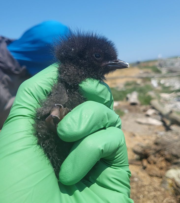
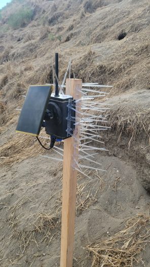
Using GPS tags, Liam, a SAFS Masters student, collects movement data which can be used to identify foraging behavior, and is transmitted from the birds to a base station that communicates with the tags. Attached via a small backpack, the tags transmit data to the base station when birds are flying back to their nests or burrows. Naturally coming off as the bird molts its feathers, 1-3 weeks of data is collected per backpack. As rhinoceros auklets forage at sea during the day, GPS tagging is conducted at night when they return to feed their young in the burrows – described as an exhilarating experience to complete in the dark by Liam and his team.

With the backpacks logging a location point every 15 minutes and attempting a connection to the base station every five minutes, this can provide a tremendous amount of data as the five-minute pulse pulls data from any backpacks within range, typically within 200m of the base station.
Liam shares that one of the particularly interesting aspects of GPS tagging is seeing the foraging habits of these birds brought to life almost instantaneously. He says it’s exciting to be to explore what goes into resource selection decisions by the tracked birds. This data is used to answer questions around if certain habitats frequented by these birds should be protected to prevent any degradation to foraging habitat, and what characteristics of these habitats are such that certain areas are chosen over others.
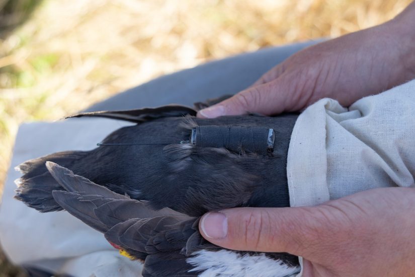
Attaching the GPS tagging backpack is the final step in the hands-on monitoring of these birds, with bill length, body length and other measurements collected first. Over the last two years, 16 GPS tags were attached per year to both rhinoceros auklets and pigeon guillemots on Protection Island.