A view from above: using drones for coastal research in California
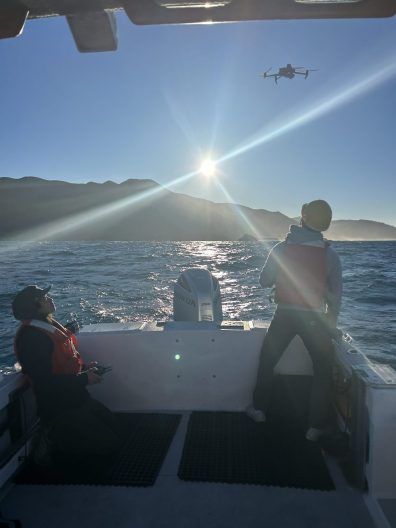
Newly based at the University of Washington is the Marine Landscape Ecology Lab (MLEL), led by SAFS Professor, Corey Garza. Conducting research along the Californian coast using drones, Corey’s lab is currently working on two projects funded by the California Ocean Protection Council.
In a collaborative effort with UC Santa Cruz, Stanford University, and the Middlebury Institute for International Studies, the team is trying to understand how the interaction between oceanographic conditions and the presence of marine mammals, impacts the presence of great white sharks.

Precipitated by recent great white shark attacks on humans in the Monterey area, California is exploring ways to try and avoid this by exploring the conditions which increase the likelihood of great white sharks being closer to shore.
Using drones to map the central California coast and the presence of pinnipeds such as sea lions, fur seals, and elephant seals, all of which are prey for great whites, the MLEL team is helping deliver new insights into what factors increase great white shark presence. As prey species stick closer to the shore, this leads sharks closer to the coast. In turn, this raises the frequency of interactions with humans who are in coastal waters, swimming, surfing, and diving.

Another factor at play is oceanographic conditions and how it impacts pinnipeds. Data has shown that pinnipeds are more commonly present onshore in April, and the team is working to get more information on monthly variation, plus improve understanding about what factors cause pinnipeds to aggregate in different coastal locations. El Niño and La Niña-related driven changes in coastal conditions may alter the abundance and distribution of prey commonly preferred by pinnipeds. This can result in pinnipeds seeking out coastal areas where their preferred prey are abundant.
With the overarching aim of public education, the institutions involved are researching a number of aspects:
- The MLEL carries out drone mapping of the coastline to record variation in pinniped abundance.
- UC Santa Cruz is mapping and track pinnipeds to see where they are diving and swimming.
- Stanford is tagging sharks and using telemetry to see where they’re going and utilizing oceanographic instrumentation to monitor changes in the coastal environment.
- The Middlebury Institute for International Studies is developing educational materials to support public outreach.
How does research fit into a public education and awareness campaign? By providing the scientific information behind California’s efforts to make local people and tourists more knowledgeable about what conditions and times of year result in a higher frequency of great white sharks.

A second project underway with Corey and his MLEL team is developing high-resolution digital elevation models (DEMs) of the rocky intertidal, also known as the rockpool area, along the entire California coastline from San Diego to Humboldt County. Building on biological monitoring data collected the Multi-Agency Rocky Intertidal Network (MARINe), a collaborative monitoring program led by UC Santa Cruz since the mid-1990s, this project will integrate MARINEe’s long-term monitoring data with digital elevation models.

Using drones to map the topography of the intertidal mussel beds across 100 sites, the team will use the topography data collected by the drones to create DEMs. These DEMs will be used to support modeling to predict how sea level rise may change the future distribution and composition of rocky intertidal communities in California.
The rocky intertidal is the frontline when it comes to climate change and associated rising sea levels. It’s also an incredibly important ecosystem from both a habitat and economic point of view. On the habitat side, the rocky intertidal is a site home to keystone species that help maintain biodiversity for the entire ecosystem, as uncovered by Robert (Bob) Paine’s foundational ecology work with ochre sea stars and mussels.
From an economic standpoint, this part of the Californian rocky intertidal is home to black and red abalone, recreational fish nurseries, and mussel beds, which are an important foraging habitat for the Pacific spiny lobster, just to name a few.
Heading out once a month to conduct drone research for both projects, the MLEL team consists of four members including Corey: graduate student Olivia Bible, post-doc Michael Espriella, and technician, Jason Ching.
Interested in related work? Check out Eos’ article with Corey Garza about tracking ocean warming and its impact on California’s mussel beds using time-series photos.
![]()